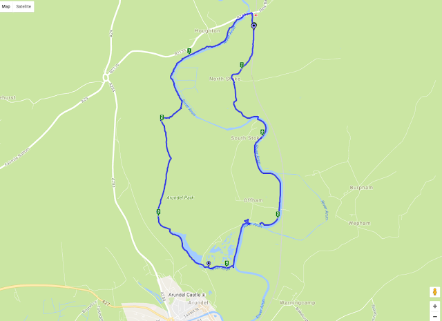
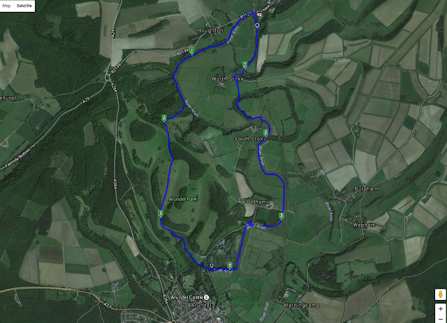
Walk time - 2.59 hours
Distance - 7.43 miles
Accent - 420 feet

We parked in Amberly just down from the station, Amberley is on the B2139 which is off the A29 coming from Chichester of the A284 if you are heading up from Arundel, there is plenty of parking and a good supply of pubs and tea rooms plus a working museum.
We walked north from where we parked the car back to the B2139 across the 'pack horse' bridge taking the footpath south straight after the bridge picking up the west side of the river Arun, we started on a raised ridge or dyke running along the side of the river which soon dropped to a very boggy and flooded area, it looked like the raised walkways were being repaired at the time we walked through as there were planks laid on the ground and the stilts were being replaced, so the walking was hard work and very wet.
 The path followed the river for around a mile and a half, apart from the short section of mud the walking was very good with nice views across the valley looking back towards the south downs, we passed a huge rope swing tied high up in a tree, this wasn't near a road or any village so I have no idea who made it or why, needless to say we had a swing!
The path followed the long distance route The Monarch's Way from here heading west away from the river and starting the only major incline on this walk
The path up this hill was very steep and on loose chalk which did make the route quite hard, this then opened out and picked on a farm track which although still steep was easier walking.
The views looking north towards Amberly and the south downs were worth the climb

We then followed the path across the top of Arundel Park and started a descent into the valley at the bottom we had two options, to take a path to the right which climbed a little and would bring us into the town of Arundel or take the path towards the mill pond and to the east side of the town and castle, we took the route towards the mill pond as we didn't plan to visit the town on this occasion.
Arundel park was quite busy with visitors wearing flip flops pushing push chairs and not following the marked paths, so we knew we were nearing a car park, we decided to take the path to the west side of the mill pond which was a lot less busy, the mill pond is large and on the opposite side had a hut to hire row boats.
We entered into a car park and if we took the right turn over the bridge we would have headed up into the town centre, we took the left turn along the south side of the wetlands park and followed a small tributary to the main river, after a short distance we came back onto the raised path along the west side of the river Arun, before we took the left turn to head north back towards Amberly we went a short way south so we could see the castle, after all we had walked this far!
Arundel castle is a proper English castle dating from the 11th century and modified over the next few hundred years, we haven't yet visited the castle but do plan to one day, it is quite spectacular to look at though and the view we had from the river Arun was worth the walk.
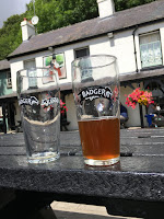
 So we about turned and headed north along the west bank of the river Arun, the path was wide and easy to follow and after about half a mile joined the road at Offham and by the Black Rabbit pub, as it was just after midday we decided to stop here for lunch, however the menu was quite substantial and not something we wanted to take on board for the rest of the walk, later I found they did do a sandwich menu, although one was not available for us to easily find, we did take on a couple of pints of Badger's Furtsy Ferret, a nice light amber ale, we weren't really hungry so not a major loss but alas I can't review the food, the pub garden was along the river bank and was very popular for good reason
Walking on through the large car park for the pub we picked up the river path again and walked for a further mile and a half before crossing a bridge at South Stoke towards North Stoke now on the east side of the river. The footpath headed across a feild and past North Stoke Farm, where we picked up Stoke Road heading north, and about a mile back to the car.

This was a really nice and relatively easy walk, the boggy path near the start was hard going but I am sure will be repaired very soon and the path above the bog on stilts replaced, the climb wasn't too high although the chalk soil was quite stoney, once we got onto the track it was much easier under foot, the descent was on a grass field and easy enough. We sprayed well with insect repellent which I think with the river and mill pond was essential, in the bottom of the valley it was quite humid and warm
Trip Advisor - The Black Rabbit
We didn't have a lunch on this occasion, but the Badger ale by Hall and Woodhouse was exceptionally nice and give us ample energy to carry on and the Black Rabbit pub was a very nice setting


